All-Weather Eye In Sky, With No Blind Spots: Why ISRO’s Latest Launch Is More Significant Than You Thought
With this satellite’s launch, all blind spots, literally and figuratively, will vanish.
Making exaggerated claims about the success of a military operation is a habit often associated with Pakistan, and rightly so. But after its air strike on a Jaish terror camp in Balakot and the ensuing dog fight in skies over Kashmir, India too was accused of overstating the success of its action in Pakistani territory.
While there is ample proof to show that the Indian Air Force (IAF) did strike with precision, India, it was reported, could not get its satellites to capture the images of the limited damage that the Spice-2000 bombs inflict on the structure they are used against just after the operation got over.
Why? The cloud cover over Balakot.
In the hours before the Mirage-2000s took to strike the camp, weather over Balakot deteriorated. As Prime Minister Narendra Modi revealed in his interview with News Nation, the weather deteriorated to an extent that the IAF had to consider calling off the operation. But in the interest of secrecy, which is essential for a surprise attack, the government went ahead with the plan.
In such conditions, it was reported that Indian satellites were unable to penetrate the clouds over Balakot and could not capture proof of the damage caused, giving Pakistan the opportunity to claim that the IAF missed its target.
“...we couldn’t get a good satellite picture on Tuesday (26 February, the day of the strike) because of heavy clouds. That would have settled the debate,” The Indian Express quoted an unnamed official as saying in its report.
Two different stories emerged in the days after the strike.
One, that the government managed to get high-resolution satellite imagery from a friendly country. These images, reports said, showed that the IAF had struck the camp with precision. However, such resource sharing arrangements between nations come with restrictions. It is likely that the imagery was shared with New Delhi under the condition that it won’t be made public. Given that the government has not released any such imagery till date despite foreign analysts and international media raising questions on its claims of success, the use of the images could have indeed been restricted by the source country.
And two, it has been claimed that the IAF had managed to get synthetic aperture radar (SAR) imagery from an intelligence aircraft platform flying in Indian airspace. India also has an Israeli-built satellite called RISAT-2, which too has a SAR capable of penetrating the cloud cover to produce images of the earth’s surface. (It was launched by ISRO in 2009, after the 26/11 Mumbai attack).
But according to The Indian Express source, the resource of the Indian intelligence agencies was ‘classified’ and did not produce very clear images.
“It is for the political leadership to decide if it wants to release that imagery and make public what is a ‘classified’ capability. The SAR images are not as clear as satellite pictures,” the source quoted by the daily had said.
It is not known which of the two—aircraft platform and Israeli-built RISAT-2—the source was talking about, but it is clear that there were limitations, either related to quality or use, because India did not release these images either.
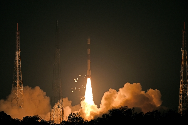
But these ‘blind spots’ will now vanish as the Indian Space Research Organisation (ISRO) has put into orbit a satellite earlier today that can penetrate through the cloud cover. The satellite, named RISAT-2B, will also use SAR, like the Israeli-built RISAT-2 and the Indian-made RISAT-1 (launched in 2012, died in 2017).
However, the RISAT-2B SAR satellite comes with no conditions attached. Also, given that it has been built and launched a decade after RISAT-2 was launched, it is expected to be much more accurate and have a finer resolution.
According to publicly available information, the Israeli-built RISAT-2, in the High Resolution Spotlight mode, has a resolution of better than 2 meter. Replacing it, the RISAT-2B has a resolution of around 1 meter.
Inclined at 37 degrees to the Equator at an altitude of 557 kilometer above the Earth’s surface, the satellite will not be capable of global surveillance. Instead, reports have claimed, it will capture areas in and around India and Pakistan.
At 615 kg, the new satellite is nearly twice as heavy as RISAT-2. This hints that the new SAR satellite is more sophisticated than RISAT-2.
A SAR satellite transmits radio signals, which are reflected from the surface. These signals are recorded when they echo back to the satellite and can then be processed to build an image of the ground. These images can give details such as size of objects on Earth, structures, movement and change. Due to their large wavelength, radio waves are not obstructed due to adverse weather or dust.
RISAT-2A is just the first in a series of radar imaging satellites that India is putting into orbit. ISRO plans to launch two clone satellites RISAT-BR1 and RISAT-2BR2 to create a network of radar imaging satellites. Another satellite, RISAT-1A is also likely to be launched this year to replace RISAT-1 launched in 2012.
Among other things, this satellite launch also involved the testing of a new low-cost light Vikram processor developed at the Semiconductor Complex Chandigarh, which, according to reports, will control future ISRO launch vehicles. The processor is used for management of different stages—solid, liquid, cryogenic and semi-cryogenic, and issue commands based on the inputs.
For this launch, a Core Alone configuration of the four-stage Polar Satellite Launch Vehicle (PSLV) was used, which is the lightest of the various versions of the launch platform. This version does not use strap-on boosters. Other versions of this launch vehicle, PSLV-DL, PSLV-QL and PSLV-XL use two, four and six boosters, respectively