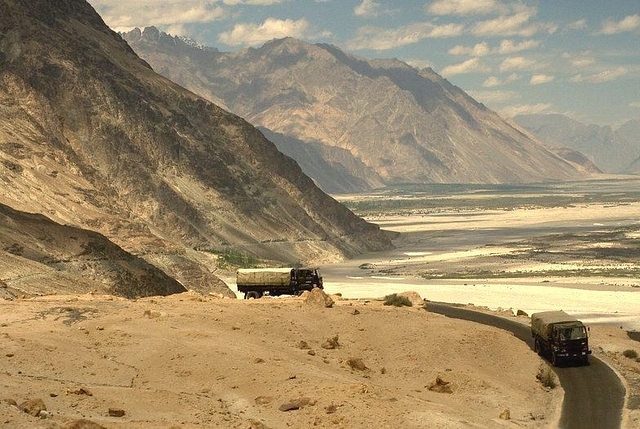
Why Ladakh Is Strategically Important For India
With the bifurcation of the state of Jammu and Kashmir, Ladakh is set to become a Union Territory. A brief on why it is of immense strategic value.
Not just for connectivity to the rest of India, but also for its development-related needs, Ladakh remained dependent on Kashmir for seven decades.
Despite its vast expanse, the region was never part of the narrative around Jammu and Kashmir, always limited to being an appendage of the Muslim-majority valley with which it shared no ethnic, linguistic or cultural similarities.
With the state’s bifurcation, the long-standing demand of this region has been met—it is free from Kashmir. But in the debate around the consequences of this move, which has largely focused on the Kashmir valley and how its population would react, Ladakh has found little mention even though it is critical with regards to security.
There’s no doubt that the Kashmir valley is the most sensitive part of the state from the security point of view, but Ladakh’s criticality can’t be ignored.
It was in Kargil, which will be part of the Union Territory (UT) of Ladakh, that India fought its last conventional war. The Siachen Glacier, which Pakistan desperately wants India to vacate, will also be part of the Ladakh UT.
Ladakh is critical for maintaining Indian presence on the Siachen Glacier as it provides physical approach to the frozen battlefield, connecting to the rest of the country. West of the Siachen glacier, across the Saltoro Ridge, lies Pakistan-occupied Gilgit and Baltistan. East of it lies China-occupied Aksai Chin. With a presence on the Siachen glacier, India has managed to prevent China and Pakistan from linking up.
If Pakistan is in possession of Siachen, former Research and Analysis Wing chief Vikram Soon explains, “it would have access from Skardu through to the Karakoram near the Aksai Chin and eventual linking with Shahidullah on the Kashgar-Xigatse road that runs parallel to the Tibet- India border”.
But, most importantly, India shares a disputed border with China in Ladakh which regularly sees transgressions by the People’s Liberation Army (PLA). Just days ahead of Chinese President Xi Jinping’s first visit to India in 2014, the PLA camped kilometers inside Indian territory in the Chumar sector.
Most recently, when the New Delhi and Beijing were engaged in an intense military stand-off in Bhutan’s Doklam, Indian and Chinese troops were seen pelting stones on each other and engaging in fisticuffs near the Pangong Lake after the latter transgressed kilometers inside territory controlled by India along the 135-kilometer long water body.
Around the Spanggur Tso lake in Chushul, not far from the Pangong Lake, India had fought a fierce battle in 1962 to stall Chinese advances towards Leh, airlifting tanks from Chandigarh to support the effort. Located in southeastern Ladakh, south of the Pangong Lake, Chushul has immense strategic value and holds an important place in the defence of the region. It lies one of the main approaches that China can use for an offensive into Ladakh and move towards Kashmir.
Further south is Demchok, around which lie flat approaches (often referred to as Demchok Funnel) from Tibet towards Ladakh. The flat terrain in this region, military strategists suggest, allows the deployment of mechanised forces. These flat approaches too can be used by China for launching an attack.
Over the years, the Chinese have built an extensive region of motorable roads in the region, which in turn is linked to the G219 Highway (connecting Lhatse and Xinjiang) passing through occupied Aksai Chin, making it easier for the PLA to patrol the region and pour in troops from Tibet and the mainland to secure it at a short notice. In Depsang, just west of occupied Aski Chin, the Chinese walked in 19 kilometers into Indian controlled territory in 2013 and pitched tents in the region.
China’s attentiveness can be gauged from the fact that when India moved troops from this region to Kargil during the 1999 war for a few months, the PLA extended a road five kilometer into Indian controlled territory along the bank of the Pangong Lake.
On the Indian side, however, infrastructure is poor. With all focus on defeating the Pakistan-sponsored militancy in the Valley, development of infrastructure in Ladakh to support the movement of troops in the region was put on the back-burner.
While things have improved in the last decade, the infrastructure gap between the two sides remains wide. Now that Ladakh will be under Center’s direct rule, development of the region should speed up.