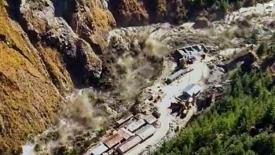
Expert Team Widens Mouth Of Rishiganga Lake By 15 Feet; Will Enable Faster Drainage And Prevent Repeat Tragedy
The 30-member expert team has widened the mouth of the lake that was formed upstream Rishiganga river by 15 feet, Hindustan Times reports.
This lake was formed by flash floods caused in Chamoli district in Uttarakhand. State Disaster Response Force (SDRF) commandant Navneet Bhullar mentioned that the lake’s mouth widening has led to quicker drainage and it will prevent another occurrence of a similar tragedy.
Bhullar added, “In a daring effort, the team has widened the mouth of the lake in a very difficult terrain, which has increased the discharge from the lake. Due to this, the chances of lake burst or Chamoli-like tragedy happening again have been averted. And our team members are still camping there to try to widen the mouth further.”
The lake’s depth was analyzed by scientists along with the personnel of the Indian Army and the Indo-Tibetan Border Police (ITBP). Subsequently, its mouth was opened proportionately to around 20-35 feet. Special equipment along with quick deployable antenna (QDA) that was based on satellite communication was established in the location and it enabled the SDRF to carry out real-time communication with the expert team.
Scientists from the Uttarakhand Space Application Centre and also the Geological Survey of India were comprised in the expert team that also included the ITBP and SDRF officials. One of the QDAs was positioned to the lake area in order to assist the expert team to communicate from the remote terrain. Two navy divers were taken to the lake through an Air Force chopper to measure its depth on Saturday.
SDRF DIG Ridhim Aggarwal claimed that hand-held echolocation devices were used for the measurement process.