Night-Time Map Released By ‘National Geographic’ Shows The Success Of India’s Rural Electrification Project
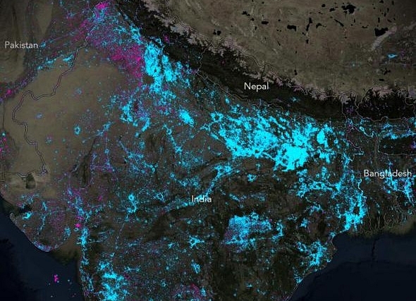
A night-time map released by television channel National Geographic, based on satellite imagery released by National Aeronautics and Space Administration (NASA), has revealed that the Indian government’s rural electrification project and the renewable energy initiative have been immensely successful. The map, comparing satellite data from 2012 and 2016, reveals where the planet has dimmed or brightened.
In the map above, it can be clearly seen that night-time glow in India’s hinterland increased between 2012 and 2016. Areas in Eastern Uttar Pradesh, Bihar and Uttrakhand are seen in blue, showing that the region that was earlier deprived of 24-hour power supply now has greater access to electricity.
“That India has brightened dramatically, as shown by all the blue in the image below, is also not a surprise. The country is home to more than its fair share of people living without electricity, and its government has been working to change that by establishing a rural electrification programme and investing heavily in renewable energy,” National Geographic has said in its report.
Satellite imagery released by NASA is a part of its "Earth at Night" programme run by the agency’s Goddard Space Flight Center. It aims to provide "the clearest yet composite view of the patterns of human settlement across our planet."
According to the agency, these images can be used to monitor changes driven by urbanisation, out-migration, economic changes and electrification.