Insta
After Decades Of Waiting, Indian Railways Will Reach Indo-China Border, Put Sikkim On Rail Map
Swarajya Staff
Apr 12, 2018, 02:12 PM | Updated 02:12 PM IST
Save & read from anywhere!
Bookmark stories for easy access on any device or the Swarajya app.
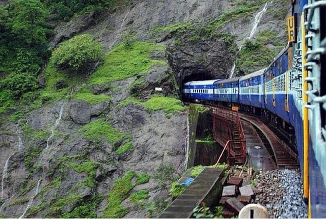
Forty three years after it became a part of India, work will finally begin on putting the Himalayan state of Sikkim on the country’s railway map. In what can be called the biggest engineering challenge for the country after the Konkan Railway, a 54 km-long broad gauge track will be built connecting the hill state via the Darjeeling and Kalimpong districts of Gorkhaland passing through the Mahananda wildlife sanctuary. The track will feature a total of 37 bridges, 13 tunnels and also go over the turbulent Teesta river.
The project – most of which passes through Gorkhaland – was stuck for the want of a no objection certificate (NOC) from the Gorkhaland Territorial Administration (GTA) which has now given its final green signal, reports Economic Times. Around 51 km of the line will pass through Gorkhaland while the remaning section would be in Sikkim.
The GTA gave its consent to the Northeast Frontier Railway (NFR) after its demands for stations in Kalimpong and Darjeeling were agreed to.
By connecting Sikkim to the rest of the Indian Railways network, the line will help increase tourism and trade in Sikkim and the adjoining areas. Currently National Highway (NH) 10 is the only land route to Sikkim.
The line will also enable quicker military movement to the India-China border. With the opening of this line, India can send troops quicker to the border region, in case China decides to increase its presence in Doklam.
Save & read from anywhere!
Bookmark stories for easy access on any device or the Swarajya app.
Introducing ElectionsHQ + 50 Ground Reports Project
The 2024 elections might seem easy to guess, but there are some important questions that shouldn't be missed.
Do freebies still sway voters? Do people prioritise infrastructure when voting? How will Punjab vote?
The answers to these questions provide great insights into where we, as a country, are headed in the years to come.
Swarajya is starting a project with an aim to do 50 solid ground stories and a smart commentary service on WhatsApp, a one-of-a-kind. We'd love your support during this election season.
Click below to contribute.