Insta
Andhra, Tamil Nadu Coasts On High Alert As Cyclone Vardah Set For Landfall
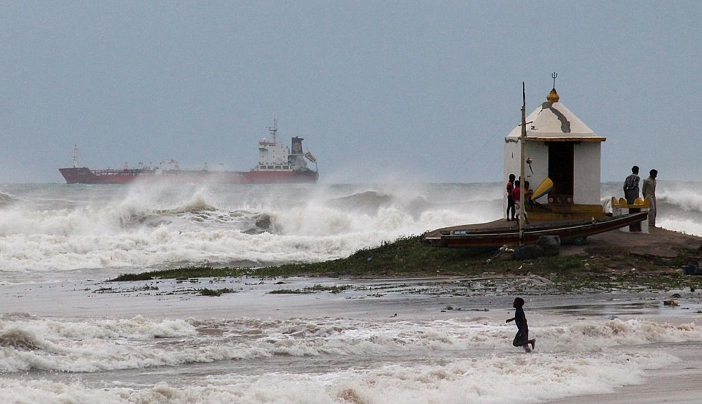
Cyclone Hudhud making expected landfall in 2014. (STRDEL/AFP/GettyImages)
High alert has been sounded and National Disaster Response Force (NDRF) teams have been pre positioned as severe cyclonic storm 'Vardah' will make a landfall between north Tamil Nadu and south Andhra Pradesh on today ( 12 December).
The MET department has predicted rainfall over south coastal Andhra Pradesh, north coastal Tamil Nadu and Puducherry over the next 36 hours. The rainfall intensity would increase gradually becoming heavy to very heavy rainfall at a few places and isolated extremely heavy rainfall over Chennai, Thiruvallur and Kanchipuram districts of Tamil Nadu and Nellore and Prakasam districts of Andhra Pradesh.
The weather department has warned of squally winds speed reaching 50-60 kmph gusting to 70 kmph along and off Andhra Pradesh and adjoining north Tamil Nadu coasts becoming 100-110 kmph gusting to 120 kmph during the time of landfall. District administrations and all field officers have been put on high alert. Army, Navy, Air-force and Coast Guard are geared up to lend a helping hand when required.
With inputs from IANS
Support Swarajya's 50 Ground Reports Project & Sponsor A Story
Every general election Swarajya does a 50 ground reports project.
Aimed only at serious readers and those who appreciate the nuances of political undercurrents, the project provides a sense of India's electoral landscape. As you know, these reports are produced after considerable investment of travel, time and effort on the ground.
This time too we've kicked off the project in style and have covered over 30 constituencies already. If you're someone who appreciates such work and have enjoyed our coverage please consider sponsoring a ground report for just Rs 2999 to Rs 19,999 - it goes a long way in helping us produce more quality reportage.
You can also back this project by becoming a subscriber for as little as Rs 999 - so do click on this links and choose a plan that suits you and back us.
Click below to contribute.
Latest