Culture
Uttarapath And Dakshinapath: The Great Trade Routes Of Jambudwipa
- The Uttarapath and the Dakshinapath routes were like a colourful thread connecting different parts of the subcontinent to each other.
- These trade routes were the pulsating veins of the body politic which rendered it alive and vibrant and communicating within itself.
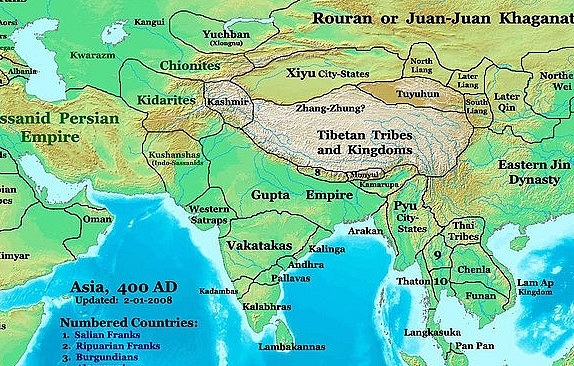
The Gupta Empire. Photo credit: WikiMedia Commons
Millennia ago, when there were no means of rapid communication, how did people, ideas and goods move? In this vast land of Jambudwipa, how did the pearls of the Pandyas and the cotton of Madurai become bywords in Pataliputra? How did the teachings of Prince Siddhartha of the Sakas reach Manimekalai, the beautiful daughter of Kovalan and Madhavi in Kaveripattinam?
It was the trade routes, along which people, goods and ideas moved. These were the pulsating veins of the body politic which rendered it alive and vibrant and communicating within itself.
Trade has been a mainstay of prosperity across time and dynasties in Jambudwipa, situated as it is in the Indian Ocean littoral. The east and the west have always been in its grasp because of its position, apart from its own vast lands and diverse products eagerly exchanged between regions.
The first mention in Sanskrit literature of trade routes or ‘panihas’ comes in the Prithvi Sukta of the Atharva Veda. It mentions the many routes and arteries of the land and the fact that they were the principal means of communication for the people, chariots and bullock carts plied on these roads and everyone had the right to use them. All had to be safeguarded against the depredations of wild animals and robbers. These safe and well-guarded routes symbolised the happiness of the earth.
The two major trade routes of the subcontinent are the Uttarapath of the north and north-west and the Dakshinapath of the centre and south of the peninsula. From about 2,600 odd years BP they became ubiquitous and even formally recognised in literature, but their genesis lies much before this.
The beginnings of civilisation in India can be traced back to what may be called the pre-Harappan cultures, roughly to the north and northwest, the plains of the Indus and Sarasvati rivers. During these times most of the trade was within the catchment areas of the cultures themselves, with Sind and Baluchistan completely interconnected and routes also connecting it to the Indus plains and the Indo-Gangetic divide. Items such as lapis lazuli, copper, silver, turquoise and ceramics and beads have been found disseminated along their routes. A central place was Mehrgarh from where external trade routes went up to Bolan, Quetta and Kandahar and from there to Iran and Turkmenia. Another route went to Kabul from where northern Afghanistan was reached.
As far as the next phase, the early Harappan phase, as it is called, is concerned, internal trade routes connected Sind and Baluchistan, the Indus plains were connected to Rajasthan, an additional axis connected the Karachi coast to the northern highlands beyond the Bari Doab and there were also lines of communication from there to the Hindukush and the Karakoram mountains. East Punjab was connected both to Rajasthan and Sind, and Sind to Gujarat.
During this period the establishment of ‘international’ trade with the Persian Gulf and Mesopotamia both by land and sea was a stunning new development. The northern overland route was to Mesopotamia through Northern Afghanistan, Northern Iran and Turkmenia, while the southern overland route was from Tepe Yahya to Jalalabad to Kalleh Nisar, and then Susa and Ur.
There was a well-developed maritime route, which went along the Gujarat, Sind and Makran coasts to the Persian Gulf.
Sea routes merit separate examination on their own with Saurashtra, Kalinga, the Tamizh and Chera lands, playing a stellar role in the story, but that is for some other time. This article focuses on the internal land routes of the Uttarapath and Dakshinapath.
There were also the cultures outside the Harappan zone spread around the rest of the subcontinent, but connected to each other and to the primary cultural area of Harappa through different routes.
As the script of the Sarasvati-Sindhu civilisation has not yet been deciphered the above description is based only on archaeological evidence.
At this stage we can take into account inscriptional and literary sources and match them to archeological evidence, and the streams coalesce.
The Uttarapath has been mentioned by name first in Panini’s Ashtadhyayi where he lists the various kingdoms along the ‘Uttarapathenahritam’. Although the term as such does not appear in the Mahabharat or the Ramayan, there are extensive actual descriptions of sectors of this route. There are extensive descriptions also in the Jatakas, the Vinaya texts and the various adaptations of the 6th century BCE story cluster the Brihatkatha of Gunadhya.
It was the major trans-regional trade route of northern India. It could be described as a land-cum-river route as the Ganga and its tributaries, the Yamuna, Ghaghra and the Sarayu were part of the communication route.
It swept across north-west India, crossed the Indo-Gangetic plains and went up to the port of Tamralipti in the Bay of Bengal.
It had a northern part, called the Haimvatapath in the Arthashastra which went through Lahore, Jullunder, Saharanpur to Bijnor, Gorakhpur, Bihar and then Bengal. The southern sector started from Lahore and went on towards Delhi, Hastinapur, Varanasi, Allahabad and then Pataliputra and Rajgir.
Manibhadra, the yaksha was the presiding deity of the traders of the Uttarapath. Massive larger than life statues of this deity have been found dating from Mauryan and Sunga periods. Interestingly, the statue of the yaksha, which stands in front of the Reserve Bank of India with a bag of money in its hand, is modeled on a Manibhadra statue found in Mathura and dated to the Mauryan period.
The Dakshinapath is also mentioned in the Arthashastra. It went from Pataliputra and Kaushambi, to Vidisha, Ujjaini and Pratishthana. Manimekalai was the presiding goddess for the traders of this route.
There were feeder routes branching off from these two great trade routes, which were connected to the seaports of the east and west coast of Jambudwipa. For instance, the Uttarapath was connected to the Rajasthan, Sind and Orissa coasts; the Dakshinapath to Virampattinam or the modern Arikamedu, through Pratishthan.
Although we do have evidence of the Harappans as traders, it would not be wrong to say that it was before and during the Mauryan period that trade really came into its own in Jambudwipa. It was not for nothing that the greatest followers of Gautam Buddha and those primarily responsible for the spread of this cult were the prosperous traders of the times.
These routes did not lose their importance no matter how ruling dynasties changed.
During the period of the Kushans, a significant and novel development was the fact that Kanishka controlled both a part of the Chinese empire and also northern India giving Indians access to the silk route and opening up new vistas for cultural and trade links.
The Red Sea route to the Roman Empire opened up spectacularly in the common era giving impetus to internal trade, too. The finds from Arikamedu, Baroda, Kolhapur, Kapisi and Taxila confirm this.
During the times of the Satvahana-Saka conflict for the ports of Broach and Surparaka other ports developed and trade shifted to the port of Muziris further down the western coast to Malabar.
The system of rivers provided an inland waterway system, which supplemented and complemented these two land routes. It is interesting to note the combination of land and river route followed by Ram, Seeta and Lakshman as they proceed to their vanavas in the Ayodhya Kand of the Valmiki Ramayan. Ferry systems were well established as the numerous stories about boat men in Hindu, Buddhist and Jain stories attest. These were all connected to the Uttarapath and the Dakshinapath in some way or the other.
The two routes met at Kaushambi on the Yamuna river, at its confluence with the Ganga, which gave it a unique importance in the ancient period. This is borne out by its deep religious and cultural significance which continues in an unbroken line even today. It is the place at which the Ganga, Yamuna and the lost Sarasvati meet. A symbolic confluence of streams from across the east and the west of Jambudwipa, all meeting at Prayag. In an interesting continuation, 82.5-degree East longitude on which is based Indian Standard Time passes through Allahabad. The importance of Kaushambi endures.
So who were the people who moved on these routes and what were the goods carried over them? Apart from merchants, monks, pilgrims, pedlars, horse traders, acrobats, actors, students and even tourists used these beaten paths to travel for their own purposes.
The goods that were traded included raw materials and finished goods moving up and down the routes.
Lapis lazuli, silver and semi precious stones were sourced from Afghanistan and Central Asia and sea shells from the east coast made their way up the Uttarapath. Rajasthan was one of the most mineral-rich parts of the subcontinent and provided semi-precious stones, and metals like silver, gold, lead, copper and iron. Sandalwood and hides were other important items.
Precious stones, shells and pearls and gold, cotton cloth and spices were important trade items on the Dakshinapath. Kautilya mentions conch-shells, diamonds, rubies, pearls and gold in the Arthashastra. Cloth from Madurai was famous across the subcontinent as was the rain-proof cloth from Gandhara and Nepal.
Coins, as a natural concomitant of trade, have been found distributed along these routes and much mapping can be done through an analysis of this numismatic evidence.
Kings travelling on their military expeditions used these same routes, Chandragupta Maurya, according to Greek sources, is said to have gone up the Uttarapath to meet Seleucus in battle on the banks of the Indus. Down along the same road came Megasthenes, the ambassador of Seleucus to spend time in the Mauryan court. Control of these trade routes was an important cause for war; indeed it was the issue of control of the Haimavatamarg, which led to the clash between Chandragupta and Seleucus.
Along these routes also travelled ideas and religions. A rough study of the expansion of Buddhism can more or less be mapped on the Uttarapath, the Dakshinapath, the Silk Route and the maritime trading lanes. With his astute and shrewd political sense Gautama Buddha concentrated on converting royalty and after that, the rich traders to his cult. The advantages were obvious, where kings led, subjects followed. Also, the age of explosive trade had made traders rich beyond the dreams of avarice. They provided money for further expansion of the cult and also popularised it as they travelled up and down the trade routes.
When Ashoka Maurya decided to adopt Buddhism for dissemination, his missionaries and monks also travelled on these very same trade routes. A reading of Buddhist sources finds them bristling with the names of trading centres and ports. Tamralipti, the end point of the Uttarapath, was the place from where and to where embassies were sent between Ashoka and Devnampiyatissa , the then King of Sri Lanka as described by the Mahavamsa, a Buddhist scripture.
Ashokan inscriptions are found along these routes as also stupas, rock cut caves, monasteries and viharas. The inscriptions had to be placed alongside the roads where people travelled for maximum dissemination. Milestones, guesthouses, wells and other amenities were also provided to traders and other travellers. Security was provided by kings although it was the concern of the caravan leaders, too.
In spite of some parallels, today’s road network does not follow exactly the same paths. It has, therefore, often been remarked that artistic and aesthetic wonders are found in India in extremely remote places. In actual fact these were places humming with trade, commerce, and cultural and religious activities in the ancient period.
The Bharhutstupa is found where the road from Ujjain and Bhilsa turns north towards Kaushambi and Sravasti. The western flank of the Deccan plateau was another old axis where many rock-cut caves are found near Aurangabad including the stunning Ajanta and Ellora caves.
There were centres of learning and culture in the north, around Takshshila, in the east around Magadha with Nalanda, Vikramshila and other universities, in the centre around Ujjain and in the south around Madurai and Kanchipuram. Scholars, intellectuals, students and artists moved up and down these centres in a vibrant exchange of knowledge.
It is said that Tholakappiar, the famous Tamizh grammarian spent some at Acharya Panini’s ashram at Salatura near Takshshila and there are reflections of this in the Tolakappiam. He would have had to travel over the arterial routes from Kanchipuram to Amravati and then catch the Dakshinapath at Pratishthan. From there maybe he went to Kaushambi to the intersection of the two great trade routes and then up the Uttarapath to Pataliputra, perhaps, before moving up to Takshshila?
Sarthas were the traders who put in an equal amount of capital to trade in goods through caravans and the leader of a caravan group was called the sarthvahak. He was in complete charge of the caravan while it moved through the trade routes, its organisation as well as security.
All the three great story clusters of Jambudwipa, the Mahabharata, Ramayan and the Brihatkatha mention trade routes, sarthas and sarthavahaks. Wonderful and evocative descriptions of vast complicated caravans are found in many places. The Nala Damayanti story has an episode when Damayanti, abandoned in the forest, comes across a caravan of traders and gets help from them, travelling to the Chedi kingdom with them. This is one of the best descriptions of a vast and complicated caravan that we have from the past.
The Buddhist Jataka tales, which derive from the Brihatkatha, are full of stories of traders, the fabulous lands and peoples they saw and the wonderful goods they traded in. The trade routes are the warp and weft of which are woven the stories of the land. To read some of the stories which spread through the trade routes, please see ‘Project Mausam, How Indian Stories Went Viral in an Earlier Age’. The stories have also left us a wealth of information helping us to reconstruct and understand trade routes through the ages.
Jambudwipa is a land mass with a hoary history, with its share or more of ups and downs, victories and vicissitudes; united under the Mauryas, fragmented again under the Sungas and Satvahanas, Kushans and Sakas; united again to some extent under the Gupta-Vakatakas, Mughals and Marathas. In this moving kaleidoscope the Uttarapath and the Dakshinapath routes were like skeins of colourful thread connecting different parts of the subcontinent to each other no matter who was the ruler for the transitory moment.
Support Swarajya's 50 Ground Reports Project & Sponsor A Story
Every general election Swarajya does a 50 ground reports project.
Aimed only at serious readers and those who appreciate the nuances of political undercurrents, the project provides a sense of India's electoral landscape. As you know, these reports are produced after considerable investment of travel, time and effort on the ground.
This time too we've kicked off the project in style and have covered over 30 constituencies already. If you're someone who appreciates such work and have enjoyed our coverage please consider sponsoring a ground report for just Rs 2999 to Rs 19,999 - it goes a long way in helping us produce more quality reportage.
You can also back this project by becoming a subscriber for as little as Rs 999 - so do click on this links and choose a plan that suits you and back us.
Click below to contribute.
Latest