Ideas
Unstable Boundaries: A Holiday Trip To Quetta Or Peshawar, Anyone?
- History is full of instances where political boundaries were drawn and erased. So it would hardly be a surprise if you plan a holiday to Peshawar, Quetta or Kabul in 10 years’ time with just about the nonchalance that you would employ to go to Patna, Quilon or Kolhapur.
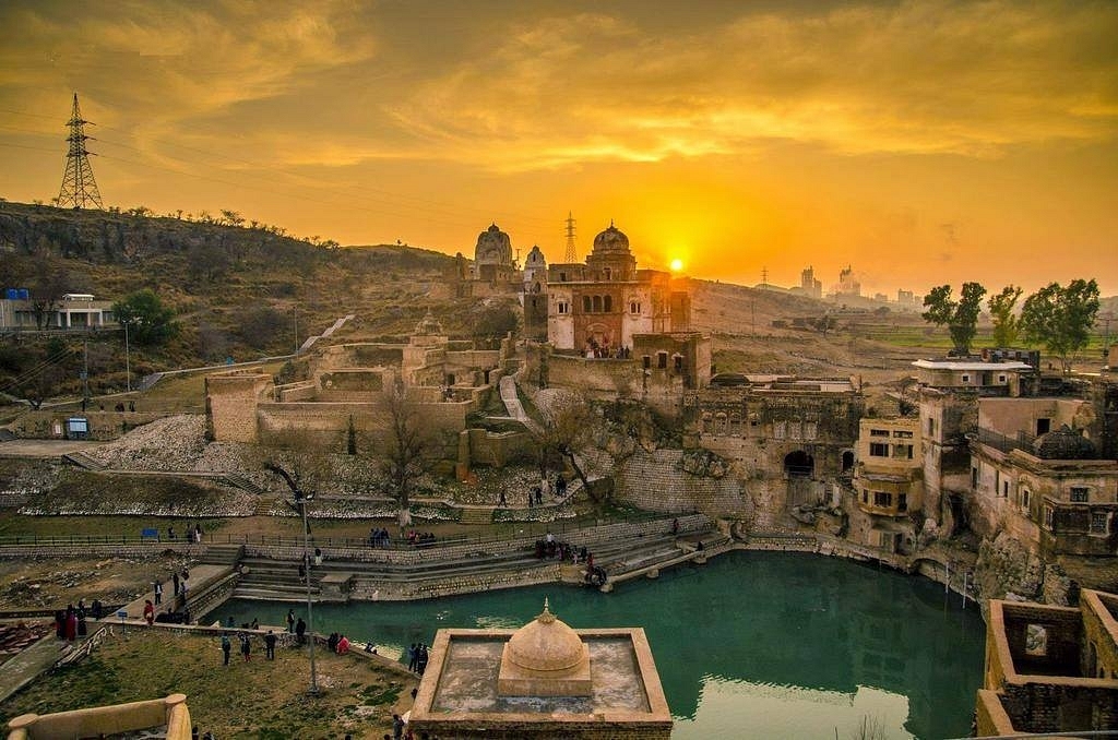
The Katas Raj temples (@TheCountryPakistan/facebook)
Cultural, social and linguistic characteristic of various peoples are shaped over centuries and are typically of a long term nature. Political boundaries, on the other hand, are man-made and are drawn or erased by the victors after major wars and conflicts. However, if the events of the past 150 years are any indication, these man-made political boundaries do not seem to have much shelf life in general. They are actually surprisingly ephemeral.
A look at the map of Europe over the last 100 years reveals this admirably. The First World War saw the end of four huge empires: the Habsburgs in Austria-Hungary, the Hohenzollerns in Germany, the Romanovs in Russia and the Ottomans in Turkey. Germany, however, bloated under Hitler to an enormous size by the early 1940s and with its vassal states controlled almost all of the European land mass. The end of the Second World War put an end to all this.
There were two Germanys of postage stamp size by 1945, and divided by a fundamental ideological conflict. The Union of Soviet Socialist Republics (USSR) and its satellite states dominated much of Central Europe and all of Eastern Europe. But these political differences were not of fundamental importance. The idea of Germany was more important than all of this and the old fault lines reasserted themselves so that we now have the Europe of 2019 with a unified Germany as its fulcrum again even if it is not of its 1914 size. One USSR became 15 or so different countries. So much for communism.
Even more amazing than all this is the number of times the British have drawn and erased such boundary lines during the last century all over the world. It is almost their default mode of governance when things go wrong. They began with their own country and carved up Ireland in 1921. They created a string of artificial countries like Iraq, Jordan, Israel, Palestine, Yugoslavia and Czechoslovakia. Some have lasted uncomfortably, while others have vanished without a trace. The list is practically endless. It would be ironical if their own realm is divided as an outcome of Brexit. Anything can happen. We could have four countries where there is just one.
But going back to the past, their crowning glory was absolutely their ‘Jewel in the Crown’. Ceylon and Burma were first lopped off from the rest of the Indian subcontinent. Finally came their magnum opus, the two headed Pakistan. One head was chopped off by India in 1971 showing the whole world the hollowness of their two nation theory — there were more Muslims in India compared to either Pakistan or Bangladesh.
The rest of Pakistan, the other head as it were, is tottering now as recent events are showing. Sindh, Balochistan and Khyber Pakhtunkhwa are all seething with separatist movements, the strongest of these being in Balochistan. The northwest of India and its environs in Central Asia have always been tempestuous and have been subjected to powerful undercurrents of history because this region lies in the fault lines of three powerful states: Russia, India and China. The Great Game of the late nineteenth century is a typical example of these undercurrents as is the Afghanistan and Iraq problems over the last several decades.
The smaller countries that lie at the junctions of these huge empires come and go: for example, all the xyz-stans. All these –stans are buffer states of the big three and are influenced one way or the other by them, and also by the underlying threads of the ancient Silk Route. This is what is permanent — not the political boundaries of today.
Given today’s situation in Pakistan, it is not so difficult to sketch how the region might look like in say, 2024 and this is what I have attempted. If the past 100 years are any indication, rearrangement of map lines could cascade quite suddenly, if other events favour such a development. The situation is metastable: a resurgent and economically strong India; a China with a flagging economy and a desire not to push India too far or too hard, and finally a Russia that wishes to antagonise neither India nor China. What are the buffer states in such a scenario? Nothing. Absolutely nothing.
My conjecture is not new and has been discussed on and off by people who surely know a whole lot more than me. I am merely a scientist. I have sketched this possibility as I would a reaction mechanism — based on existing facts and the known behavioural patterns of countries and individuals.
As eminent a person as Dr Subramanian Swamy has suggested this for sometime now as a favourable policy strategy for India, and he is surely aware of the geopolitical and strategic niceties and is also well aware of the capabilities of India to play a crucial catalytic role in such a transformation with Balochistan surely being an incendiary point.
All this is in the realm of the believable. A look at the famous Brandenburg Gate in the heart of Berlin before and after the collapse of communism is revealing. I crossed Checkpoint Charlie in 1978 and saw the passport controls, guard dogs and barbed wire. The next time I visited Berlin was in 1990 and again in 1991 and I strolled through the very same gate with a friend eating an ice cream. So don’t be surprised if you are able to plan a holiday to Peshawar, Quetta or Kabul in 10 years’ time with just about the nonchalance that you would employ to go to Patna, Quilon or Kolhapur.
Support Swarajya's 50 Ground Reports Project & Sponsor A Story
Every general election Swarajya does a 50 ground reports project.
Aimed only at serious readers and those who appreciate the nuances of political undercurrents, the project provides a sense of India's electoral landscape. As you know, these reports are produced after considerable investment of travel, time and effort on the ground.
This time too we've kicked off the project in style and have covered over 30 constituencies already. If you're someone who appreciates such work and have enjoyed our coverage please consider sponsoring a ground report for just Rs 2999 to Rs 19,999 - it goes a long way in helping us produce more quality reportage.
You can also back this project by becoming a subscriber for as little as Rs 999 - so do click on this links and choose a plan that suits you and back us.
Click below to contribute.
Latest