News Brief
Explained: "Scientific" Demarcation Of Assam-Mizoram Border Through Satellite Imaging
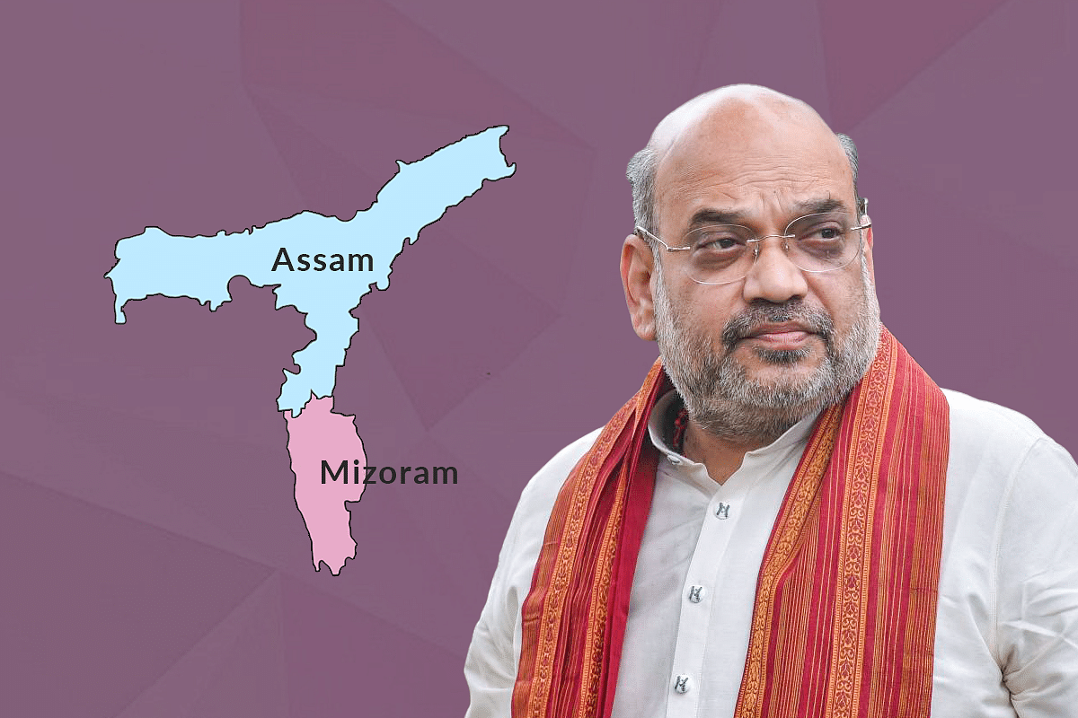
- North Eastern Space Applications Centre will begin the satellite mapping of Assam-Mizoram border areas to help scientifically demarcate the inter-state boundaries.
- In January, Home Minister Amit Shah had suggested that NESAC uses the same technology to map out the forests and demarcate the inter-state boundaries.
Home Minister Amit Shah
Following the suggestion made by Home Minister Amit Shah months back, the North Eastern Space Applications Centre (NESAC) has been roped in to do satellite mapping of Assam-Mizoram border areas to help scientifically demarcate the inter-state boundaries.
NESAC is a joint venture between the Department of Space, Government of India and the North Eastern Council (NEC). NEC is an advisory body constituted under the North Eastern Council Act 1971 as the nodal agency for the economic and social development of the eight states—Arunachal Pradesh, Assam, Manipur, Meghalaya, Mizoram, Nagaland, Sikkim and Tripura.
Shillong-based NESAC already uses satellite technology for flood management in the region. Home Minister Shah, who heads the NEC, is also the head of the NESAC.
The major objective of the NESAC is to provide remote sensing and geographic information to support activities on development, management of natural resources, disaster management, education and health care services, and infrastructure planning in the region.
In the NEC meeting held on 23 January in Shillong this year, Shah suggested that NESAC uses the same technology to map out the forests etc., in the border areas for a scientific demarcation of boundaries between the states. The process has now reportedly started. Shah had also chaired a meeting of NESAC during his visit to the northeast last month.
Border Disputes In Northeast
The crux of the dispute is that Mizoram rejects the 1933 demarcation of districts done by the British, saying that Mizo tribal chiefs were not consulted at the time, while Assam backs the 1933 demarcation. Mizoram supports the Cachar Inner Line of 1875 under the Bengal Eastern Frontier Regulation of 1873.
When Mizoram gained statehood in 1987, Mizo tribal leaders raised the border dispute claiming that Assam had taken away their land.
Since then, the border has been a site of persistent clashes. In October 2020, clashes left several injured on both sides and resulted in a 12-day blockade of National Highway 306, the lifeline to Mizoram. About 20 shops and houses were torched, and over 50 people were injured in the clashes. Days before this, on 9 October, similar violence took place on the border of Karimganj (Assam) and Mamit (Mizoram) districts.
Most recently, the exchange of fire between Assam police personnel with their Mizoram counterparts left six — five Assam police personnel and a civilian — dead. The clashes in the border town of Vairengte also left at least 60 persons from Assam injured.
How Satellite Imaging Will Help
Satellite imaging uses the images of the earth as captured by the sensors deployed on satellites rotating around the earth. Using different image processing techniques, both qualitative and quantitative properties of the landscape can be ascertained.
Different earth surface features like rivers, forests, mountains, as well as their characteristics like whether the forest is deciduous or coniferous, whether the river water is clean or polluted, can be determined. Residential areas, slums and squatter settlements; garbage and other forms of solid waste; and different types of crops and plants are mapped.
Based on this data, a scientific demarcation of boundaries can be done. High-resolution satellite imagery analysis can also provide early warning of conflict at the border. Apart from establishing protocols that minimise chances of clashes at the border, the government can also explore this option.
Support Swarajya's 50 Ground Reports Project & Sponsor A Story
Every general election Swarajya does a 50 ground reports project.
Aimed only at serious readers and those who appreciate the nuances of political undercurrents, the project provides a sense of India's electoral landscape. As you know, these reports are produced after considerable investment of travel, time and effort on the ground.
This time too we've kicked off the project in style and have covered over 30 constituencies already. If you're someone who appreciates such work and have enjoyed our coverage please consider sponsoring a ground report for just Rs 2999 to Rs 19,999 - it goes a long way in helping us produce more quality reportage.
You can also back this project by becoming a subscriber for as little as Rs 999 - so do click on this links and choose a plan that suits you and back us.
Click below to contribute.
Latest