Science
ISRO Receives India-US Jointly Built NISAR Earth Observation Satellite, Begins Preparations For Launch
NISAR
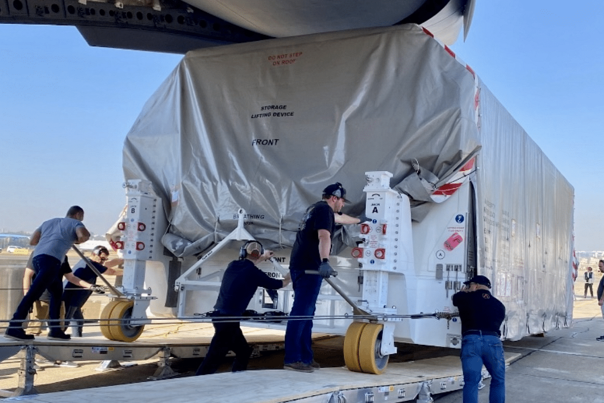
US space agency NASA has handed over NISAR earth observation satellite to ISRO.
The satellite arrived at Bengaluru airport from NASA's Jet Propulsion Laboratory (JPL) in California onboard a US air force's C-17 aircraft.
NISAR – short for NASA-ISRO Synthetic Aperture Radar – an Earth science satellite has been jointly built by NASA and the Indian Space Research Organisation (ISRO).
The satellite has been moved to its next destination, U R Rao Satellite Centre in Bengaluru, for carrying out further testing and assembly with ISRO’s satellite bus in preparation for a 2024 launch from Satish Dhawan Space Centre in Andhra Pradesh.
"The integrated payload of NISAR comprising ISRO’s S-band Radar and NASA’s L-band Radar reached Bengaluru in the early hours of March 6, 2023 and moved to UR Rao Satellite Centre, Bengaluru for carrying out further testing and assembly with ISRO’s satellite bus," the Indian space agency said in a statement.
JPL, which is managed for NASA by Caltech in Pasadena, leads the US component of the project and is providing the mission’s L-band synthetic aperture radar.
NASA is also providing the radar reflector antenna, the deployable boom, a high-rate communication subsystem for science data, GPS receivers, a solid-state recorder, and payload data subsystem.
ISRO is providing the spacecraft bus, the S-band SAR, the launch vehicle, and associated launch services and satellite mission operations.
NISAR will gather radar data with a drum-shaped reflector antenna almost 40 feet (12 meters) in diameter. It will use a signal-processing technique called interferometric synthetic aperture radar, or InSAR, to observe changes in Earth’s land and ice surfaces down to fractions of an inch.
Over the course of its three-year prime mission, the satellite will observe nearly the entire planet every 12 days, making observations day and night, in all weather conditions.
The observations NISAR makes will help researchers measure the ways in which Earth is constantly changing by detecting both subtle and dramatic movements.
"Slow-moving variations of a land surface can precede earthquakes, landslides, and volcanic eruptions, and data about such movement could help communities prepare for natural hazards. Measurements of melting sea ice and ice sheets will improve understanding of the pace and impacts of climate change, including sea level rise," NASA said in a statement.
Further, observations of the planet’s forest and agricultural regions will improve the knowledge of carbon exchange between the atmosphere and plant communities, reducing uncertainties in models used to project future climate, the US space agency said.
Support Swarajya's 50 Ground Reports Project & Sponsor A Story
Every general election Swarajya does a 50 ground reports project.
Aimed only at serious readers and those who appreciate the nuances of political undercurrents, the project provides a sense of India's electoral landscape. As you know, these reports are produced after considerable investment of travel, time and effort on the ground.
This time too we've kicked off the project in style and have covered over 30 constituencies already. If you're someone who appreciates such work and have enjoyed our coverage please consider sponsoring a ground report for just Rs 2999 to Rs 19,999 - it goes a long way in helping us produce more quality reportage.
You can also back this project by becoming a subscriber for as little as Rs 999 - so do click on this links and choose a plan that suits you and back us.
Click below to contribute.
Latest