Tech
4D Digital Twins: The Future of Cartography
- The advent of a 4D twin promises to elevate various aspects of our lives, from infrastructure management and tourism enhancement to environmental control and even the concept of "time travel".
- It marks a significant step towards advancing cartography to a whole new dimension.
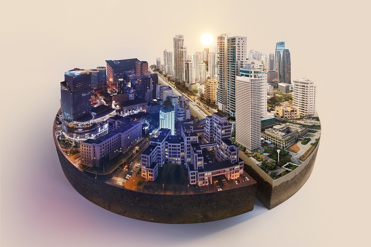
With 4D digital twins cartography is experiencing a transformative phase.
A four dimensional (4D) digital twin of a city or region is a virtual map detailing the minute aspects of the location by using real time data from sources that include drones, cameras, sensors, the Internet-of-Things (IoT) and other data gathering systems.
The 4D twin includes not only three spatial dimensions but also the dynamic of time (ie, it is not static).
The technology to do this already exists and cities like Singapore are on their way to create a one-to-one model of their city-state.
Soon, many cities around the world will do this. This is a true break from the past as, till now, the field of cartography has been essentially two dimensional.
The visual representation of this 4D information simplifies the understanding of a dynamic and intricate situation. In today's world, it holds significant importance across various domains.
Real-time monitoring and intervention become possible, enabling optimisation of the physical world through simulations for effective planning. Instant data access facilitates industries to achieve higher accuracy, efficiency, and cost savings.
In real-world scenarios, errors are often unacceptable, but with digital twin simulations, solutions can be tested beforehand, reducing risks in practical implementation.
This technology can serve as a public utility, allowing citizens and businesses to provide valuable feedback. Let's explore some specific future implementations of this technology.
City Infrastructure
21st century cities are extremely complex ecosystems that are constantly changing and evolving. Managing such complex systems requires accurate and real time inputs.
The digital twin allows the city managers to not only gather information from various kinds of sensors and citizens but to visually represent it for easy understanding.
Drainage: When building city infrastructure, though overlooked, aspects like drainage are essential especially in cities with high risk of flooding. For example, in Mumbai, due to the lack of adequate drainage and flood planning, during each monsoon, there is waist high water in certain choke points, such as places like the bottom of flyovers.
A digital twin could allow a simulation of the water flow to ensure there are no such choke points. This water can then be channelled off the roads and diverted to catchment areas. This water can then be recycled for other uses as is done in places like Singapore with their reservoir system.
An example of a city that could have benefited from the use of a digital twin simulation is Dubai when they experienced flooding in several choke points after their cloud seeding project. Had they been able to simulate the water flow, they could have anticipated the problems and managed the water flow better.
Managing urban microclimate and improvements in air quality: City heat as a result of the urban heat island effect may seem like a relatively insignificant problem.
However, it can have effects such as a decrease in productivity, damage to public mental and physical health and higher energy costs. Optimised airflow allows for heat and polluted air to be dispersed effectively instead of getting trapped and accumulating.
A digital twin of a city will give planners the ability to test the effects of each new building on the heat and wind pattern of a city by testing how changes in the architectural design and density affect these factors.
This will also allow for improved compatibility between buildings long term to maintain a certain air quality and city temperature standard.
A digital twin will also allow for areas with high heat and pollution accumulation to be identified easily which could allow relevant authorities to prioritise high problem areas.
Road traffic, public transport and pedestrianisation: Traffic problems can be tackled by testing different intervals (phases) for the traffic lights.
Adjustments to traffic routes and road infrastructure can be simulated to optimise traffic flow.
For example, different types of interchanges can be planned and simulated before investing in them. Congestion prone regions can be identified in real time and appropriate measures can be taken.
A digital twin can help improve walkability by testing the effects of pedestrianising certain areas. This would also help reduce the volume of traffic long term as it would reduce people’s dependence on cars. In addition, critical areas which lack public transportation can be easily identified.
This would consequently decrease road traffic load by allowing authorities to prioritise which routes to create and manage first. Furthermore, a digital twin of a road network could allow for autonomous vehicles to better traverse the roads.
Public Services: A digital twin can provide services like giving the optimal route for a quick response team and mapping various trends over time. This twin could also act as a common ground platform which could improve the collaboration between all public services.
Defence And Safety: Vantage points and safe routes for high profile movement can be planned better. It would also allow for more accuracy in urban warfare/anti-terror operations. Using this technology, training can be optimised as security threat situations can be accurately simulated by using virtual reality to recreate settings with high risk (government buildings, etc). Integrating this technology into defense systems would allow for unmanned vehicles to operate better in urban/semi-urban environments. At the moment, it is difficult to maintain navigation and communication with unmanned aerial and ground vehicles in these environments due to heavy interference in the navigational equipment. The integration of this software into defence systems would allow for these vehicles to be used effectively.
Fire Risk: Areas with higher fire risk (slums, developments near forests, areas near factories, etc) can be identified and listed. This will allow local authorities to allocate more resources towards fire safety and regulation. This technology can also be used to identify areas with no fire truck access and viable exits. It would also be able to provide early fire detection and a higher quality of fire prevention through the use of sensors and historical data. Fire spread within each building can be simulated and thus planned for.
Healthcare: Tracking and managing epidemic outbreaks as well as the identification of the source will allow medical infrastructure to adjust, act and advise accordingly.
Law Enforcement: With more data and evidence collection equipment spread across the city, breaking the law will be far harder to do without facing the consequences. Facial and licence plate recognition will allow for the suspect to be tracked with ease. This technology will allow the mapping of higher crime areas to be updated in real time.
Other Services: A major issue in dense cities today is the pile up of litter, garbage and debris. Polluted zones can be identified and targeted. Regular garbage collection can be monitored and schedules can be better planned. It will also help road repair and cleaning services by identifying areas which need action (potholes, fallen trees, faded lane markers, etc). This same idea can be applied to other services such as animal welfare services. For instance, if there is a wild bear in a residential area, people can be informed and the authorities can be alerted.
Architecture And Real Estate
Factors like the average amount of light and noise levels, proximity to green space/nature and such information can be displayed in the digital twin using a colour map.
This can then be reported for buyers to analyse. The demographics of an area can also be tracked and used by both planners and consumers. For example, a younger person would likely prefer to stay in an area with a youthful buzz.
Planners can also use this technology to see how different architectural designs fit with the surroundings instead of doing trial and error or manual digital remodeling.
Town regulators can monitor if the construction code/regulations are followed. For example, the Singapore government can enforce their building painting laws using this technology.
Aviation: Digital twins are already heavily in use in real world flight simulators where aspiring pilots can learn about flying in different conditions using a variety of different aircraft styles without any risk.
Shopping/Commercial: Businesses can track everything from consumer clusters to delivery routes. Shops can adapt their opening hour, orientation of the shop, etc, based on the flow of customers. Consumer habits and preferences can be tracked and mapped for businesses to use for optimisation.
This technology will also allow consumers to test several products beforehand. For example, people will be able to see how a pool or a basketball court would look in their backyard before investing in them.
Agricultural: A 4D twin can be used in many agricultural aspects. The monitoring of water/electricity usage will be made easy. Irrigation channels can be simulated beforehand and monitored to ensure optimal function.
This technology can also help monitor crop growth and predict future outcomes.
Quality of fertilisation and water used can be measured as well as the nutrient concentration of water for hydroponics and aquaculture to maximise productivity.
Diseases and weeds can also be detected early. The real time data allows for air quality, humidity and temperature to be better maintained in indoor settings.
Greenfield Projects: These are projects made from scratch on land that hasn’t been previously built on. Before starting a project, the land can be mapped and projects can be planned more efficiently and accurately according to the terrain and surrounding features.
For instance, terrain contour data and water level simulations over time can help with developing flood control and prevention solutions (flood walls, etc).
Similarly, in landslide prone areas, simulations can help map high risk regions and allow planners to protect their projects. This tool will be especially useful in projects which involve heavy terraforming/land reclamation.
Tourism: Tourist attractions can be optimised to their specific needs. A virtual reality experience can allow tourists to give tourists an incentive to visit in the future.
For example, if somebody wanted to visit the historic Hauz Khas Complex in New Delhi, they could walk around virtually to see if its something they would be interested in before making the trip in the physical world (this already exists and is practised in some form).
People with handicaps which prevent them from traveling to certain places would also be able to visit these places virtually and get to experience it in some capacity.
For example, someone who is paralysed can experience a place which would otherwise be inaccessible to them. Booking hotels will also be far easier since you can see the surrounding area and view data on the hotel with ease beforehand.
Gaming: Video game environments can be directly based on real world locations by importing scans. This is already done in genres such as racing games where real world circuits are replicated digitally with an extremely high level of detail.
“Time Travel”: Overtime, as cities change, a digital twin of the real world may allow people of the future to revisit the past and experience it.
For example, using a digital twin, someone in 2100 would be able to go back in time to 2050 to see what was there in “x” location at that time. This would allow us to better track our world over time. We will not only be able to learn from the past but we will be able to experience it.
As can be seen from the above discussion, a 4D digital twin has many uses. We already have two dimensional versions that have emerged in the last decade such as Google Maps and Mappls.
These have revolutionised the way people navigate as well as developed new ways of leveraging geographical knowledge.
A 4D twin will allow us to move to the next level where everything from the managing and planning of infrastructure, enhancing the tourism experience, managing the environment and even “time travel” will be possible. It is time to take cartography to the next dimension.
Support Swarajya's 50 Ground Reports Project & Sponsor A Story
Every general election Swarajya does a 50 ground reports project.
Aimed only at serious readers and those who appreciate the nuances of political undercurrents, the project provides a sense of India's electoral landscape. As you know, these reports are produced after considerable investment of travel, time and effort on the ground.
This time too we've kicked off the project in style and have covered over 30 constituencies already. If you're someone who appreciates such work and have enjoyed our coverage please consider sponsoring a ground report for just Rs 2999 to Rs 19,999 - it goes a long way in helping us produce more quality reportage.
You can also back this project by becoming a subscriber for as little as Rs 999 - so do click on this links and choose a plan that suits you and back us.
Click below to contribute.
Latest