News Brief
Ladakh: Here’s A New Satellite Image Of Galwan Valley Bridge Built By India During Standoff With China
Swarajya Staff
Mar 05, 2021, 12:46 AM | Updated Mar 05, 2021, 11:58 AM IST
Save & read from anywhere!
Bookmark stories for easy access on any device or the Swarajya app.
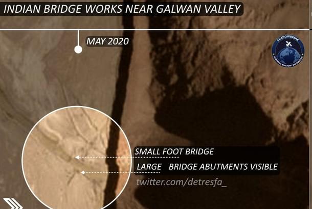
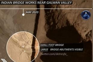
A new satellite image of the bridge India built near the Galwan Valley last year, during the standoff with China in the area, has emerged.
The satellite image, which appears to have been taken in August 2020, shows vehicles moving across the bridge. The high-resolution satellite picture was posted on Twitter by open-source intelligence handle @detresfa_.
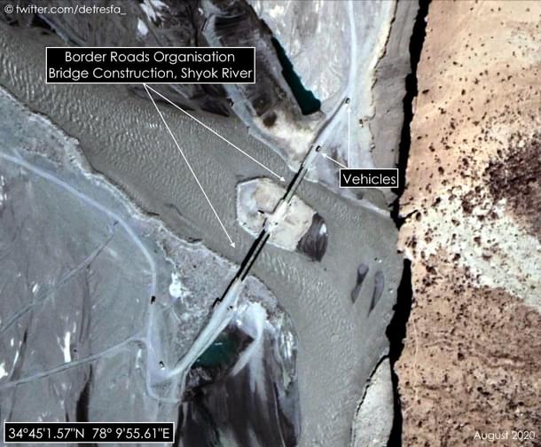
India had completed the construction of a bridge in the Galwan Valley, sometime around 18 June last year, only a few days after the deadly clashes between Indian and Chinese troops in the area, India Today reported.
After the clashes in the Galwan Valley, which left 20 Indian Army personnel and an unknown number of Chinese soldiers dead, the Indian Army was ordered to accelerate and finish the construction of the bridge.
Even as the scale of clashes in the Galwan River valley was becoming clear, the Indian Army's Karu-based mountain division asked the Army Engineers unit to speed the construction of the critical bridge.
After the bridge was completed in June, the Indian Army tested it for over two hours with its vehicles, a report in India Today said back then.
By speeding up the construction of the bridge despite deadly clashes with China in the area, India told China that it will not stop developing critical infrastructure on its side of the Line of Actual Control, experts had said back then.
The 60-meter bridge provides the Indian Army better connectivity in the area, allowing military vehicles and soldiers to cross the stream safely.
Called a 'bailey bridge', which is a portable, pre-fabricated, truss bridge, it allows rapid movement of military vehicles of all kinds, including heavy ones, such as infantry combat vehicles of the Indian Army.
In the middle of the standoff and a raging pandemic, construction teams worked day and night to complete the work on the bridge.
Reports say the bridge is located close to the confluence of the Galwan and Shyok rivers, only a few kilometres away from the Line of Actual Control.
In 2020, despite the standoff in eastern Ladakh, the Border Roads Organisation (BRO), which is responsible for the construction of roads and bridges in the border areas, improved its record over last year.
The Defence Ministry’s Year-End Review for 2020 says BRO completed around 1,993 km of formation cutting work, and executed nearly 2,341 km of surfacing work and construction of 2,683 meters of bridges.


