Defence
Preempting China: How Army Occupying Heights South Of The Pangong Lake In Ladakh Helps India
- If China hadn’t been preempted and the PLA managed to occupy the heights, the resulting situation would not only have been bad for India strategically, but also adverse tactically for the troops on the ground.
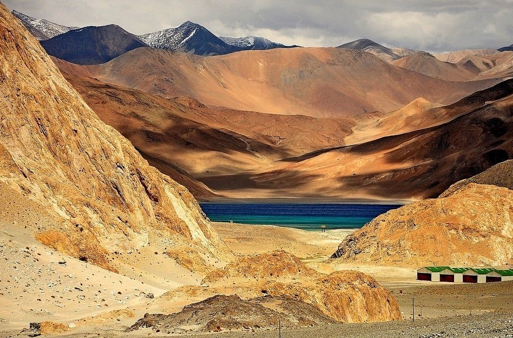
Pangong Tso
On the intervening night of 29 and 30 August, the Indian Army, aided by men from 7 Vikas, a Special Frontier Force unit manned by volunteers from the Tibetan community in India, captured the heights lying between the southern bank of the Pangong Lake and the smaller Spanggur Lake further south.
There are differing accounts of what transpired, and the description above may need corrections and/or additions as new details emerge, but what’s increasingly clear are the reasons and motivations behind this Indian operation.
First, the strategic reason for this operation.
With little to no headway on disengagement, India felt compelled to occupy a piece of contested territory. Being in control of the heights India has occupied gives it a better negotiating position as it discusses with China the withdrawal People’s Liberation Army (PLA) from the territory it has occupied since May.
Over the last few months, Indian negotiators, both from the Army and the Ministry of External Affairs, have come to realise that the Chinese are not keen on restoring status quo ante of April by moving back from the new territory they have occupied in eastern Ladakh, most importantly the area between Finger 4 and Finger 8 on the northern bank of Pangong Tso.
While some reports say that the Chinese haven’t followed through on the ground what they have agreed to on the table regarding the dispute at the north bank of Pangong Tso, others say the PLA is unwilling to even discuss the issue.
In light of these facts, occupying contested territory and using it in negotiations was the most viable option India had. Any Indian attempt to dislodge the Chinese from the occupied territory militarily — weather it can be done or not is another debate — could have dangerously escalated the crisis.
The other reason, which the Indian Army hinted at in its statement on the new round of tensions on 31 August, was tactical — to 'preempt' China from occupying the heights after it made 'provocative military movements'.
If China hadn’t been preempted and the PLA managed to occupy the heights, the resulting situation would not only have been bad for India strategically, but also adverse tactically for the troops on the ground.
To understand how the operation benefits India tactically, one must first understand the geography of the region south of Pangong Tso.
South of Pangong Lake lies India’s Chushul sector, which, as the above map depicts, has the village of Chushul, the Spanggur Lake and the heights and positions that India is said to have occupied — Black Top and Helmet Top, which lie just south of Pangong Lake’s southern bank, and Renchin La (called Reqin La by the Chinese), which lies south-west of the Spanggur Lake.
Near the western end of Spanggur Lake lies a nearly two-kilometre wide break in mountains called the Spanggur Gap. This gap opens into the Chushul Valley (which, as one moves south, becomes narrower and is called Demchok Funnel — a flat top approach from Tibet towards Ladakh).
India claims slightly more than half of the Spanggur Lake as part of Ladakh. However, in control of the entire lake at least since the 1962 war, China has built a large presence around it, especially along its south bank, where it has multiple camps. These camps have only swelled since the standoff began in May.
China has built an extensive road network in the area, right up to the Spanggur Gap. This network of roads connects the PLA bases in the area with the Tibet-Xinjiang Highway (Highway 219) in the Tibetan town of Rudok.
The Indian Army has long believed that China, in the event of hostilities or war, can try to launch an offensive towards Chushul through the Spanggur Gap.
The flat approach from the gap towards Chushul and the southern bank of the Pangong Lake makes the use of mechanised infantry and armour (tanks) possible in such an attack.
Bringing these elements to this area and sustaining them is not a problem for the PLA given the road linking the Lake with the Tibet-Xinjiang Highway.
In October 1962, in the middle of the war with China, India had airlifted six AMX-13 tanks of the 20 Lancers to Chushul for deployment at the Spanggur Gap. Airlifted from Chandigarh, the tanks landed at the Chushul airfield onboard the Indian Air Force’s An-12 transport aircraft, which had been inducted just months ago. The Chushul airfield, now inactive, lies only a few kilometres west of the gap.
Tanks were deployed at the gap in 1962, Major General S V Thapliyal (retired) writes in the USI Journal, to “deny Spanggur gap approach to the enemy, particularly to armour which may try to venture out towards Chushul”.
Back then, the tanks of the Indian Army, although very few in number and plagued by many operational difficulties (among other things, their automatic loading gear froze) at that height, helped delay the Chinese advance.
It was only after the PLA captured Gurung Hill, a height overlooking the Spanggur Gap from the north, that they were able to force the Indians to retreat.
Like the 1962 conflict, tanks have been deployed in the current crisis as well. While the Indian Army has moved a regiment of T-90 main battle tanks, China is said to have deployed both light and heavy tanks in the area close to Black Top.
Indian and Chinese tanks, multiple reports say, are “stationed within firing distance of each other” near the gap. Both sides have also brought in thousands of troops along with artillery guns and other equipment to the area.
With the Indian Army now occupying positions on heights both north (Black Top and Helmet Top) and south (Requin La) of the Spanggur Gap, its ability to thwart a Chinese attempt to ingress through the gap has increased significantly.
India is better placed to thwart such an attempt now than it would have been if the PLA had occupied the heights north and south of the Spanggur Gap.
Fully armed Indian troops sitting on these heights atop the ridgeline, including those overlooking the Spanggur Gap, can not only monitor movements of the Chinese forces deployed in the larger area south of the Pangong Lake but also dominate a number of PLA camps and positions around the Spanggur Lake.
As both Indian and Chinese forces learned in 1962, controlling the heights around the Spanggur Lake is critical for dominating the Spanggur Gap and the larger area south of Pangong Tso. Having these heights is more critical for India as Chushul, which lies on the road to Leh, is located very close to the gap.
Support Swarajya's 50 Ground Reports Project & Sponsor A Story
Every general election Swarajya does a 50 ground reports project.
Aimed only at serious readers and those who appreciate the nuances of political undercurrents, the project provides a sense of India's electoral landscape. As you know, these reports are produced after considerable investment of travel, time and effort on the ground.
This time too we've kicked off the project in style and have covered over 30 constituencies already. If you're someone who appreciates such work and have enjoyed our coverage please consider sponsoring a ground report for just Rs 2999 to Rs 19,999 - it goes a long way in helping us produce more quality reportage.
You can also back this project by becoming a subscriber for as little as Rs 999 - so do click on this links and choose a plan that suits you and back us.
Click below to contribute.
Latest