Insta
Here Are NASA’s Before And After Pictures Of The Kerala Flood Revealing The Scale Of Devastation
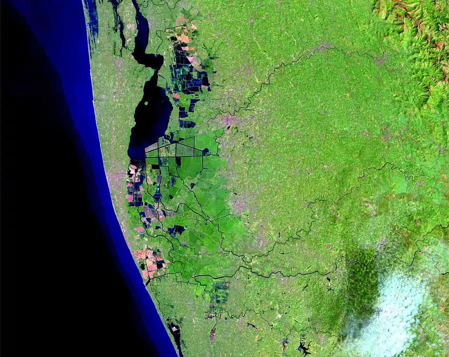
The ‘before’ picture released by the American space agency on 6 February.
The National Aeronautics and Space Administration (NASA) has released before and after pictures of the area affected by the recent flood in Kerala, showing the scale of devastation in the region due to unrelenting rains.
While the ‘before’ picture released by the American space agency was taken on 6 February 2018, the ‘after’ picture was taken on 22 August.
Drag the slider across images to compare the two pictures:
The image taken in February by the Operational Land Imager on Landsat 8 satellite shows the condition in the area before the flooding. The one taken in August by the European Space Agency’s Sentinel-2 satellite shows the level of inundation in areas following intense rainfall and the opening of dam gates.
In the picture taken on 22 August, it can be clearly seen that a large part of the state, extending from North to South, was under water.
According to NASA, the rainfall peaked in Kerala on 20 July and reached abnormally high levels between 8 to 16 August. The state, as a result, received 164 per cent more than average rainfall from 1 to 10 August.
In another post last week, the space agency had said that the release of water from dams came ‘way too late’. It had said that the lifting of many dam gates, many of which were lifted for the first time, was not done in a coordinated manner.
“The dam releases came way too late, and it coincided with the heavy rain that was occurring,” said Sanjay Kumar of NASA's Goddard Space Flight Center.
Support Swarajya's 50 Ground Reports Project & Sponsor A Story
Every general election Swarajya does a 50 ground reports project.
Aimed only at serious readers and those who appreciate the nuances of political undercurrents, the project provides a sense of India's electoral landscape. As you know, these reports are produced after considerable investment of travel, time and effort on the ground.
This time too we've kicked off the project in style and have covered over 30 constituencies already. If you're someone who appreciates such work and have enjoyed our coverage please consider sponsoring a ground report for just Rs 2999 to Rs 19,999 - it goes a long way in helping us produce more quality reportage.
You can also back this project by becoming a subscriber for as little as Rs 999 - so do click on this links and choose a plan that suits you and back us.
Click below to contribute.
Latest