Defence
After Alternate Route To Depsang, BRO Starts Constructing 'Black-Top' Road On Northern Bank Of Pangong Tso
Ujjwal Shrotryia
Jul 03, 2023, 04:43 PM | Updated 04:58 PM IST
Save & read from anywhere!
Bookmark stories for easy access on any device or the Swarajya app.
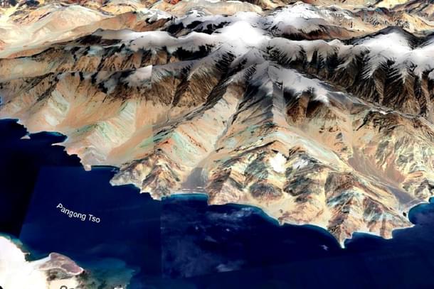
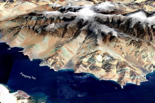
The Border Roads Organisation (BRO) is constructing a 'black-topped' road on the northern bank of Pangang Tso, after working to create an alternate axis of connectivity to Daulat Beg Oldie (DBO).
This comes when the Chinese are close to completing the construction of a bridge connecting the northern bank of Pangang Tso to the lake's southern bank.
A secondary bridge, adjacent to the main bridge is already completed, while the construction work on the main bridge is ongoing.
The black-topped road that the BRO is constructing, is estimated to be completed by 2025.
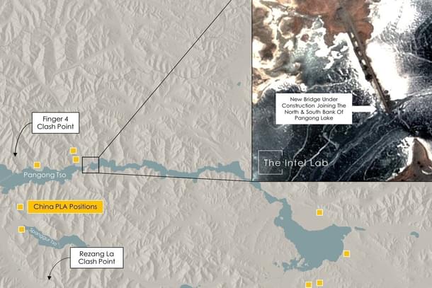
The road will be constructed till the Finger-4 on the northern bank of Pangong Tso, and will help mobilise troops faster in the event of any hostility with the Chinese.
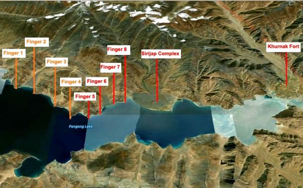
While India holds area upto the western side of Finger-4 (map above), which is also called Foxhole Point or Foxhole Ridge, and claims that the LAC runs through Finger-8, China claims that the LAC is close to Finger-2.
India has been sending patrols upto Finger-8 for years while the Chinese patrol upto the eastern side Finger-4.
“Construction of black-topped road towards Finger-4 on our side is on and is expected to be completed by 2025. There is major impetus on infrastructure, road networks, advanced landing grounds and so on," an officer said.
India has an Indo-Tibetan Border Police (ITBP) base till Finger-3. The Chinese, on the other hand, has a road from Khurnak Fort till Finger-4, which the Chinese constructed when Indian Army was engaged in Kargil war in 1999.
The area from Finger-4 to Finger-8 is under the Indian perception of Line of Actual Control (LAC), which the Chinese claims to be their territory.
The BRO is also constructing an alternate route to Darbuk-Shyok-Daulat Beg Oldie (DS-DBO) road, that many experts claims as the main reason of Chinese aggression on the LAC.
The DS-DBO road on many locations is extremely vulnerable to interdiction by the Chinese due to its closeness to the LAC. In some locations the road is 5-6 kilometre away from the LAC.
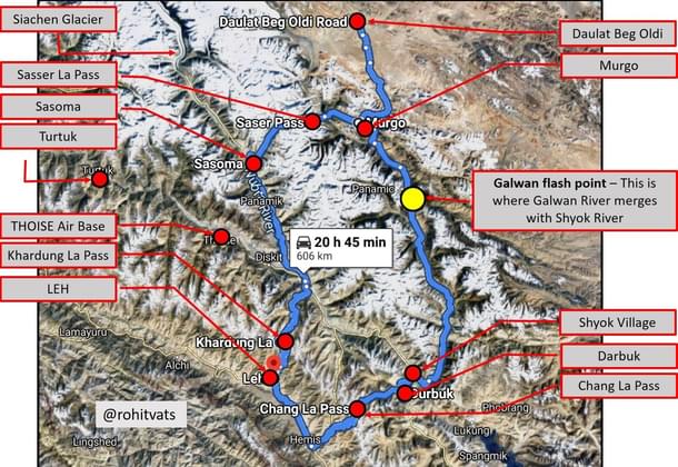
The alternate route will connect Sasoma to Murgo passing through the indomitable 17,800 feet Saser La pass, bypassing most of the DS-DBO route.
Just last month (on 8 June), BRO released tenders for construction of a 4-kilometre part of the under construction Sasoma-Murgo route.
The route, however, from Murgo till DBO, passes through the same alignment as the DS-DBO route, which is very close to the areas claimed by the Chinese. This is the same area where the Chinese are blocking Indian Army patrols, till Patrol Points 10, 11, 12 and 12A.
Another alternate route, from the base of Saser La to the DBO, through Gapshan is under planning stages, as well.
Staff Writer at Swarajya. Writes on Indian Military and Defence.
Get Swarajya in your inbox.
Magazine