Defence
India Is Upgrading Two Key Airbases On China Border — Latest Satellite Imagery Here
Swarajya Staff
Apr 30, 2024, 11:36 AM | Updated 11:36 AM IST
Save & read from anywhere!
Bookmark stories for easy access on any device or the Swarajya app.

India has been extensively upgrading two of its key airbases near the boundary with China, as shown by the latest satellite imagery.
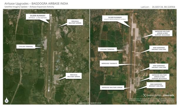
One of these is the Bagdogra Airbase, located in West Bengal's Darjeeling, in the vulnerable Siliguri corridor, also called the 'Chicken's Neck,' which connects the states in the northeast with the rest of India.
The latest satellite imagery shows that the runway at the airbase has seen major improvements over the last few months, and new hardened shelters, used for the protection of aircraft during attacks, have also been constructed.
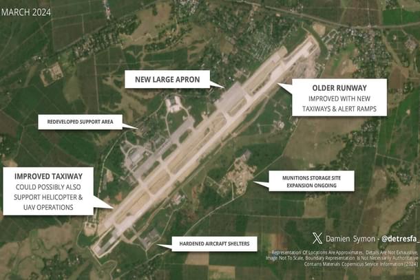
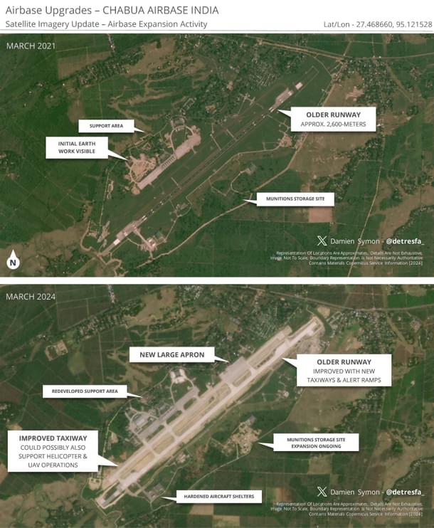
Similarly, the Chabua Airbase, located in Assam's Dibrugarh, has also undergone significant upgrades, as shown by imagery from March 2024.
The upgrading of infrastructure at airbases is not happening in isolation.
The Border Roads Organisation (BRO) has been building roads and bridges along the boundary with China at a breakneck pace, despite China deploying thousands of soldiers on the Line of Actual Control since April 2020.
In March of this year, the BRO finished linking the crucial Nimmu-Padum-Darcha (NPD) road, providing a new and faster way to reach Leh in Ladakh from the rest of India.
This 298-kilometre road creates a third route to Ladakh, which is shorter than the existing two routes available to the military until now.
Get Swarajya in your inbox.
Magazine