Infrastructure
Bengaluru Metro Phase III: Geotechnical Investigation To Begin On 45 Km Corridor
V Bhagya Subhashini
May 06, 2024, 03:52 PM | Updated 03:51 PM IST
Save & read from anywhere!
Bookmark stories for easy access on any device or the Swarajya app.

Bengaluru's Metro system is gearing up for a significant expansion with the commencement of Phase III. The Bangalore Metro Rail Corporation Limited (BMRCL) has announced the initiation of geotechnical investigations to ensure the stability and efficiency of the upcoming metro infrastructure.
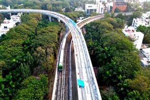
Phase 3 of the metro project will span 44.65 km with two elevated corridors and a total of 31 metro stations.
The first corridor, extending over 32.15 km along the western side of the Outer Ring Road, connecting J P Nagar's fourth phase to Kempapura, will include 22 stations and will also connect to the Airport Line.
The second corridor, covering a distance of 12.5 km from Hosahalli to Kadabgere on Magadi Road, will feature nine stations.
BMRCL officials revealed that the geotechnical investigation, valued at approximately Rs 6 crore, will commence next week. This crucial assessment will focus on examining the physical properties of the soil and rocks along the proposed routes.
"Through meticulous analysis of soil stability, rock formations, and other geological factors, engineers aim to determine the depth and design of foundations necessary for the metro pillars, ensuring the structural integrity of the metro," stated officials, as per The Hindu report.
The Karnataka government had greenlit Phase III earlier this year, envisioning the integration of 44.65 km of new lines into the network by 2028. The estimated cost for this ambitious endeavour stands at Rs 15,611 crore.
Revenue Minister Krishna Byre Gowda, following a cabinet meeting in March, disclosed that the state government would shoulder 80-85 per cent of the total project cost, with the remaining portion to be covered by the centre. The project has already secured approval from the union government, with the Detailed Project Report (DPR) finalised.
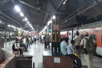
Currently, the city metro stands as India’s second longest operational metro network, spanning 73.81 kilometres, following the Delhi Metro.
Two operational corridors serve the city. The East-West Corridor stretches 43.49 kilometres, running from Whitefield Station in the east to Challagatta Terminal in the west.
The North-South Corridor covers 30.32 kilometres, with Nagasandra Station marking its northernmost point and Silk Institute Station situated at its southern end.
V Bhagya Subhashini is a staff writer at Swarajya. She tracks infrastructure developments.
Get Swarajya in your inbox.
Magazine