Infrastructure
Kerala: New Thiruvananthapuram Master Plan 2040 Proposes Special Development Zones And Transit-Oriented Development
V Bhagya Subhashini
Jun 26, 2023, 01:20 PM | Updated 01:20 PM IST
Save & read from anywhere!
Bookmark stories for easy access on any device or the Swarajya app.
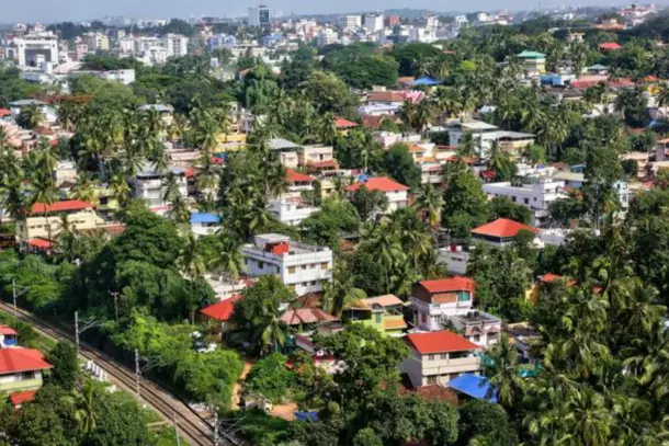

The draft master plan 2040 of the Thiruvananthapuram Corporation of Kerala proposes a land use pattern that designates 77 per cent of the city's area for built-up use.
The plan also includes special development zones to address the scarcity of land availability for various projects. These spatial zones are derived based on the future transportation development scenario.
The special development zones, one of the largest demarcations in the plan, occupy a significant area of the city.
These zones are intended to provide facilities for an intense mixed development of all major uses, including residential, commercial, public/semi-public, and industrial.
The area has been marked based on recent development patterns of the city, which have shown a mixed trend rather than a segregated development pattern.
The master plan proposes decentralising public transport to decongest the city centre, in line with previous proposals.
The plan suggests converting existing bus terminal infrastructure into major and minor hubs catering to intercity and intracity traffic respectively.
The major hubs will be located at Enchakkal, Anayara, Peroorkada, and Pappanamcode, while the minor hubs will be at Kazhakuttam, Vikas Bhavan, Thampanoor, and Vizhinjam. Dedicated circular routes will connect the major and minor hubs.
The proposed mobility hub will be developed in special zone A, which aims to create a multi-mode mobility hub near Kochuveli. This hub will serve as the convergence point for various mass transit transport systems.
Special zone B is earmarked for the expansion of the Government Medical College campus, as per a separate master plan. Special zone C will address land scarcity for developmental projects in scarcely developed areas not coming under areas to be conserved.
A total of 274 acres of such land has been identified.
The new master plan designates about 7 per cent of the land area for non-built uses, but environmentally suitable activities are allowed in these areas.
Land reserved for conservation accounts for about 4 per cent of the land use, while special development zones aimed at planned development constitute about 1.5 per cent of the land use.
Transit Oriented Development
The city's transit oriented development (TOD) zone aims to improve work-home connectivity by facilitating mixed residential and commercial development along identified mobility corridors.
The old National Highway (NH) 47 and the NH bypass are two TOD corridors featured in the plan. The NH-47 corridor is densely packed with job centres, commercial centres, educational institutions, and medical facilities.
The plan calls for a TOD zone of 250 metres on either side of the designated TOD route in the original NH and NH bypass.
The presence of IT centres along the NH bypass corridor is the primary reason for picking this route. Techno Park now employs over 56,000 professionals, and with such a large potential population and the core premise of live-work relationships, walkable communities might be created along this corridor, making it a hotspot for TOD.
Criticism For Present Plan
The latest draft master plan takes a more liberal approach in demarcating areas where construction activities are restricted, considering the controversies over the previous draft that had to be withdrawn in 2014 due to public protests.
However, the present plan has received criticism from business-related bodies for not considering the future developmental needs of the city.
Several organisations in the district criticised that the provisions in the plan will not only slow down the growth of the city but will also affect future developments, according to The New Indian Express report.
V Bhagya Subhashini is a staff writer at Swarajya. She tracks infrastructure developments.
Get Swarajya in your inbox.
Magazine


