Insta
Kerala: After Opposition To Satellite Survey For Ecologically Sensitive Zones, LDF Government Releases Forest Department Map
Swarajya Staff
Dec 23, 2022, 03:35 PM | Updated 04:06 PM IST
Save & read from anywhere!
Bookmark stories for easy access on any device or the Swarajya app.

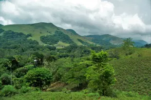
After facing massive backlash, the Left Democratic Front government has decided to keep aside the findings of the satellite survey and instead use a Forest Department map, to delineate human settlements in the 0-1 kilometre range of protected areas in the state.
The map is colour-coded to differentiate the land usage, which is, agricultural land, residences, commercial buildings etc.
The map is accessible online and can be used by the public to file objections by 7 January.
According to the protestors, the preliminary report of the satellite survey has captured just about 50,000 structures out of the estimated 2 lakh structures in the 0-1 km range of these protected areas.
Once an area is declared to be an Ecologically Sensitive Zone (ESZ), certain activities like major hydroelectric projects, commercial mining etc., are prohibited, but most other common human activities are permitted or allowed with safeguards.
The government intends to request the Supreme Court to exempt all human habitations within the 0-1 km range from the ESZ by saying that the state does not have much inhabitable land and if lot of people are displaced, it would be extremely difficult to rehabilitate them.
Also Read: Kerala: Protests Against Satellite Survey Of Eco Sensitive Zones
Get Swarajya in your inbox.
Magazine