Insta
NASA’s To Launch Its Most Advanced Laser Instrument For Measuring Change In Earth’s Ice Caps
Swarajya Staff
Aug 30, 2018, 05:21 PM | Updated 05:21 PM IST
Save & read from anywhere!
Bookmark stories for easy access on any device or the Swarajya app.
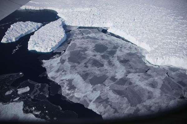
National Aeronautics and Space Administration (NASA) will be launching an advanced laser instrument to measure changes in polar ice caps in detail, PTI has reported.
The Ice, Cloud and land Elevation Satellite-2 (ICESat-2) as a result would measure the average yearly elevation change of land ice covering Greenland and Antarctica to within the “width of a pencil”. The satellite which will be launched on 12 September will capture 60,000 measurements per year.
“The new observational technologies of ICESat-2 a top recommendation of the scientific community in NASA's first Earth science decadal survey will advance our knowledge of how the ice sheets of Greenland and Antarctica contribute to sea level rise”, NASA’s Michael Freilich told PTI .
The Advanced Topographic Laser Altimeter System (ATLAS) instrument on board the satellite can measure the time taken by a photon to reach earth and return back to the satellite. Time measured by the instrument is accurate up to a billionth second. This data will be used to measure elevation. ICESat-2 will also measure the height of ocean and land surfaces.
Get Swarajya in your inbox.
Magazine