Newsletters
Weaponised Imagery: How Maxar’s Satellite Data May Be Helping Pakistan
Swarajya Staff
May 10, 2025, 06:51 PM | Updated 06:51 PM IST
Save & read from anywhere!
Bookmark stories for easy access on any device or the Swarajya app.
Satellite Imagery Being Used By India Is A Double-Edged Sword
Dear Reader,
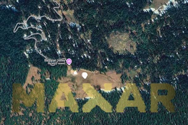
Did the same satellite imagery firm whose data helped India strike terror camps also aid Pakistan-based terror camps in planning attacks?
This piece dives into how Maxar Technologies—whose imagery was key to India’s precise strikes in Operation Sindoor—is also supplying the same data to Pakistan through a convicted nuclear smuggler’s firm.
What does this mean for national security? What can India do about it?
Read the full story below to understand how commercial satellite data has become a silent battlefield—and what India must urgently reconsider.
Kupwara Codes: The Gorkha Garrison Series
An ISI-backed terror plot is set to explode in Kashmir—and only two Gorkha officers can stop it.
As coded messages from a faceless enemy emerge, Lt Deepak Lathwal and Maj Danny Deka lead their khukri-wielding battalion into a dangerous mission across borders and betrayals.
Facing a radical femme fatale, sleeper cells, and a ticking clock, the question isn’t just if they’ll survive—but whether India will.
Fast-paced, gripping, and grounded in real-life courage—this military thriller keeps you turning pages till the very last shot.
Get Swarajya in your inbox.
Magazine