Columns
Why India’s Own Navigation Satellite System Will Be A Boost For Its Armed Forces
Swarajya Staff
Apr 28, 2016, 05:37 PM | Updated 05:37 PM IST
Save & read from anywhere!
Bookmark stories for easy access on any device or the Swarajya app.
- With the launch of the IRNSS-IG, India is all set to have its own navigation satellite system
- Here’s why its important militarily:
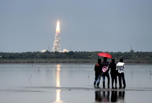
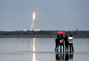
The Indian Regional Navigation Satellite System (IRNSS) is a step closer to reality with the launch of the seventh and final satellite of the system—the IRNSS-IG. With this, India will now have its own indigenously built navigation satellite system.
ISRO has laid special emphasis in ensuring all segments of the IRNSS- the ground control units, receivers and the space based units are produced in India and remain in Indian control. There has been ample indication that the primary customer of the system would be the Indian military, although there is enough scope for civilian use too.
The importance of such a network can be understood from the fact that the Chinese built their own positioning system back in early years of this century, and have granted Pakistan access to the same. The system now consists of nearly 20 satellites with likely full global coverage. The Russians and the Americans had built their own versions many decades ago.
The planned completion of the IRNSS comes at exactly the much needed time-frame for the armed services. A number of new platforms and initiatives are beginning to bear fruit - almost all of them could use access to a military grade positioning system that remains in India’s controls.
First, the locally built nuclear submarine INS Arihant is likely to be inducted into the Indian Navy as soon as May. It would carry 12 K-15 medium range (700km) ballistic missiles or 4 K-4 long range (3500 km) ones. While these systems may use other ways of positioning and navigation, an Indian GPS is sure to help and may even be a necessary prerequisite for a full scale deployment.
Hence the importance of positional accuracy and coverage in the Indian ocean region (IOR). Think a few more nuclear submarines safely lurking away in the depths of the IOR - beyond the reach of Chinese and Pakistani missiles.
Second, India’s ballistic missile program is ready for the big leap. If things go to plan, DRDO may test-fire its first canisterised long range ballistic missile capable of hitting targets 5,000 km away (Agni-V).
After pre-induction trials and a production run, the missiles are likely to be inducted around 2017-18. Once again, an Indian controlled navigation and positioning system is crucial to navigational accuracy and safety.
Third, on the tactical side a number of regiments of Brahmos cruise missile regiments have been inducted. Apart from Brahmos, the locally developed equivalent of the famous American Tomahawk cruise missiles (labelled Nirbhay) will mature at some point in the next 2-3 years. Both the Brahmos and Nirbhay are capable (and need) of using a satellite based navigation/positioning system for enhancing the accuracy of their reach.
Should all the above mentioned three areas go according to plan they offer a significant enhancement in terms of reach and accuracy of weapons delivery for the Indian armed forces. New capabilities are coming online - if the cruise missile program goes well Indian missile units in Uttar Pradesh or Assam could strike deep into Tibet without breaking a sweat.
Brahmos units could take our important bridges and communication nodes. A fleet of nuclear submarines loitering around the IOR armed with nuclear missiles quietly enhances India’s strategic posture multi-fold. All of them could use the IRNSS.
Lastly, the IRNSS may not be about just big ticket items such as long range missiles, nuclear weapons and cruise missiles alone. Locally built UAVs, aerospace platforms and even ground units could really feel the pinch if the positioning systems were in foreign hands during conflict time.
All of these put together are changing the nature of warfare and the battlefield in the subcontinent. The Americans, Chinese, EU and Russians underwent this transformation in the last two decades of the previous century. India is arriving quite late into the picture. But at-least the Desi-GPS is about to be ready.
Get Swarajya in your inbox.
Magazine