News Brief
Third Route To Ladakh: Defence Ministry To Decide On Shinkun La Tunnel As BRO, NHIDCL Give Different Proposals
Swarajya Staff
May 19, 2021, 02:01 PM | Updated 02:01 PM IST
Save & read from anywhere!
Bookmark stories for easy access on any device or the Swarajya app.

The third route linking Ladakh to the rest of the country could soon reach a step closer to completion as the Ministry of Defence is close to making a call on the alignment of the Shinkun La tunnel.
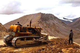
The 297-km long Nimmu-Padum-Darcha road or the third axis to Ladakh starts at Nimo, which lies on the Leh-Srinagar highway, 35 km before Leh.
The road is aligned along the course of Zanskar river till Padum, after which it follows the Lungnak river till Purne village and the Kurgiakh river till Shinkun La pass, which is located on the border of Himachal Pradesh and Ladakh.
The road meets Manali-Leh highway in Darcha, a village in Himachal’s Lahaul And Spiti district.
With some parts of the road, like the stretch between Darcha and Shinkun La, having already been constructed, work is underway on other parts. The most critical missing link in this route to Ladakh is a tunnel, which has to come up at Shinkun La.
The Center for Snow and Avalanche Study Establishment, a laboratory of the Defence Research and Development Organization, has in its study of the region and its geology suggested three option for the alignment of the tunnel.
The first of these option is a 4.25-kilometre tunnel located at a distance of 36.5 km from Darcha (99 km stone on Manali-Leh highway). The other two options are a 7-km tunnel and a 13.81-km tunnel.
A report in the Hindustan Times says the Border Roads Organisation (BRO) has suggested going ahead with the option of building a 4.25 km long tunnel, while the National Highways and Infrastructure Development Corporation (NHIDCL) is in favour of the third option, which involves the construction of a 13.81-km-long tunnel.
BRO, the report says, has argued that the 4.25-km tunnel will offer the “best gradient, least overburden and least support requirements".
NHIDCL, it adds, has projected the 13.5-km tunnel option as a “shortest route linking the Atal Tunnel to the Nimmu-Padum-Darcha road”.
In September 2020, when tensions between India and China escalated following Indian Army’s operation on the Kailash Range, NHIDCL had speeded up work on the detailed project report, the Ministry of Defence said back then.
The Nimmu-Padum-Darcha road is critical for the Indian Army not only because this alignment is much more secure than the two existing routes (Srinagar-Leh and Manali-Leh roads) to Ladakh but also because this road will be the first all-weather route between Ladakh and the rest of the country.
Get Swarajya in your inbox.
Magazine


